EQUIPMENT
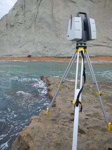
Leica ScanStation P50
Leica ScanStation P50 is the fastest and safest, long range 3D laser scanner. Unlike any other laser scanner, the P50 solution maximises productivity by scanning inaccessible places at a safe position on site, reducing time in the field with less setups. The Leica ScanStation P50 delivers:
- Highest quality 3D data and HDR imaging
- Extremely high-speed scan rate of 1 mio points per second
- Ranges of up to 1 kilometre
- Low range noise
- 3D colour point clouds
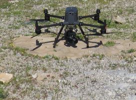
Matrice 350 RTK
An upgraded flagship drone platform, the Matrice 350 RTK features powerful propulsion, enhanced protection rating, and excellent flight performance, allowing it to effortlessly tackle a wide variety of challenges.
- RTK Positioning Accuracy (RTK FIX) 1 cm + 1 ppm* (horizontal), 1.5 cm + 1 ppm (vertical)
- Max Wind Speed Resistance 12 m/s
- Max Flight Time 55 minutes
- Supported DJI Gimbal Zenmuse P1
- Global Navigation Satellite System GPS + GLONASS + BeiDou + Galileo
- Operating Temperature -20° to 50° C
*1 ppm means the error has a 1mm increase for every 1 km of movement from the aircraft.
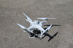
Phantom 4-RTK
The Phantom 4-RTK UAS system is the most compact and accurate low altitude mapping solution.
- Takeoff Weight 1391 g
- Positioning Accuracy:
- Vertical 1.5 cm + 1 ppm(RMS)
- Horizontal 1 cm + 1 ppm(RMS)
- Camera Sensor 1" CMOS; Effective pixels: 20 M
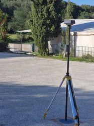
D-RTK 2 Mobile Station
D-RTK 2 Mobile Station supports the Phantom 4-RTK missions by providing real-time differential data to the drone and forming an accurate surveying solution or acquire accurate location coordinates when used as an RTK rover.
The Mobile Station’s rugged design and OcuSync transmission system ensures you can gain centimeter-level accurate data with your Phantom 4 RTK in any condition.
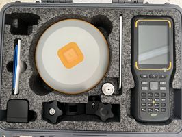
Hi-Target iRTK-5 set
Equipped with two GNSS antennas, the iRTK set is used as Base or/and Rover. High quality scalable GNSS receiver provides an industry-leading GNSS RTK surveying solution.
- Real-time kinematic precision 8 mm H/ 15 mm V
- Static precision
- Horizontal 2.5mm + 0.1ppm
- Vertical 3.5mm + 0.4ppm
- Signal tracking GPS,GLONASS, Galileo, BDS, QZSS, SBAS
